
Badlands Fieldcraft: Land Navigation Skills and Techniques, Part 1
Originally posted on Badlands Fieldcraft. -NCS
Land navigation is a combination of technical ability and skills derived from practice. You have to know how to best use the tools you have available to navigate. I think the sheer luxury of GPS with it’s constant “you are here” beacon letting you know with relative accuracy where you are at any given time is lost on those who have never learned to navigate in the first place. They just don’t know what they don’t know.
In a recent land navigation article I wrote about the tools I’ve learned to use, and how I use them. In this article I’d like to share other less tangible techniques that I’ve learned to utilize with those tools. This and a lot more will all be taught in the Fieldcraft class.
Types of land navigation
There’s basically two methods of land navigation with a map, dead reckoning and terrain association.
When dead reckoning you are solely relying on your compass azimuth and pace count. You basically are following your azimuth without deviating, going from waypoint to waypoint and keeping track of the distance you’ve travelled by your pace count. Imagine trying to navigate in a dense fog at night when you can only see 20 feet. You have no idea what the terrain around you looks like and you have no landmarks to use, all you can do is follow your azimuth and measure the distance traveled on that azimuth.
On the other hand we have terrain association. If we can identify terrain features on the map and in person, we can use this information to help us navigate. That’s not to say we won’t use our compass as well, but these landmarks give us a lot more information that we can use. By keeping track of our distance and direction to various terrain features we can triangulate where we are.
To do this we need to understand and identify what terrain features there are.
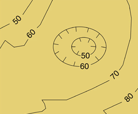
Five Major Terrain Features
Topographical maps depict the topography, or terrain, of an area by using contour lines spaced at regular elevation intervals. When using a topo map the contour lines will create predictable shapes depending on the terrain. There are five major terrain features that usually when combined create either a ridge line (not the same as a ridge, more on that in a minute) or a mountain. By understanding how to identify these features we can use them to terrain associate, making our lives much easier when trying to navigate.
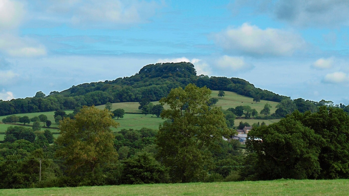
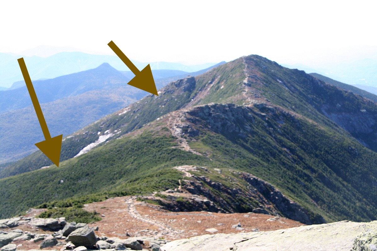
Hill – A hill is a terrain feature that rises above the terrain around it. On a topo map the contour lines will look like concentric rings, with the top of the hill at the center of the rings. While hilltops offer excellent visibility, you can also be silhouetted more easily as well as they are quite obvious places for observation.

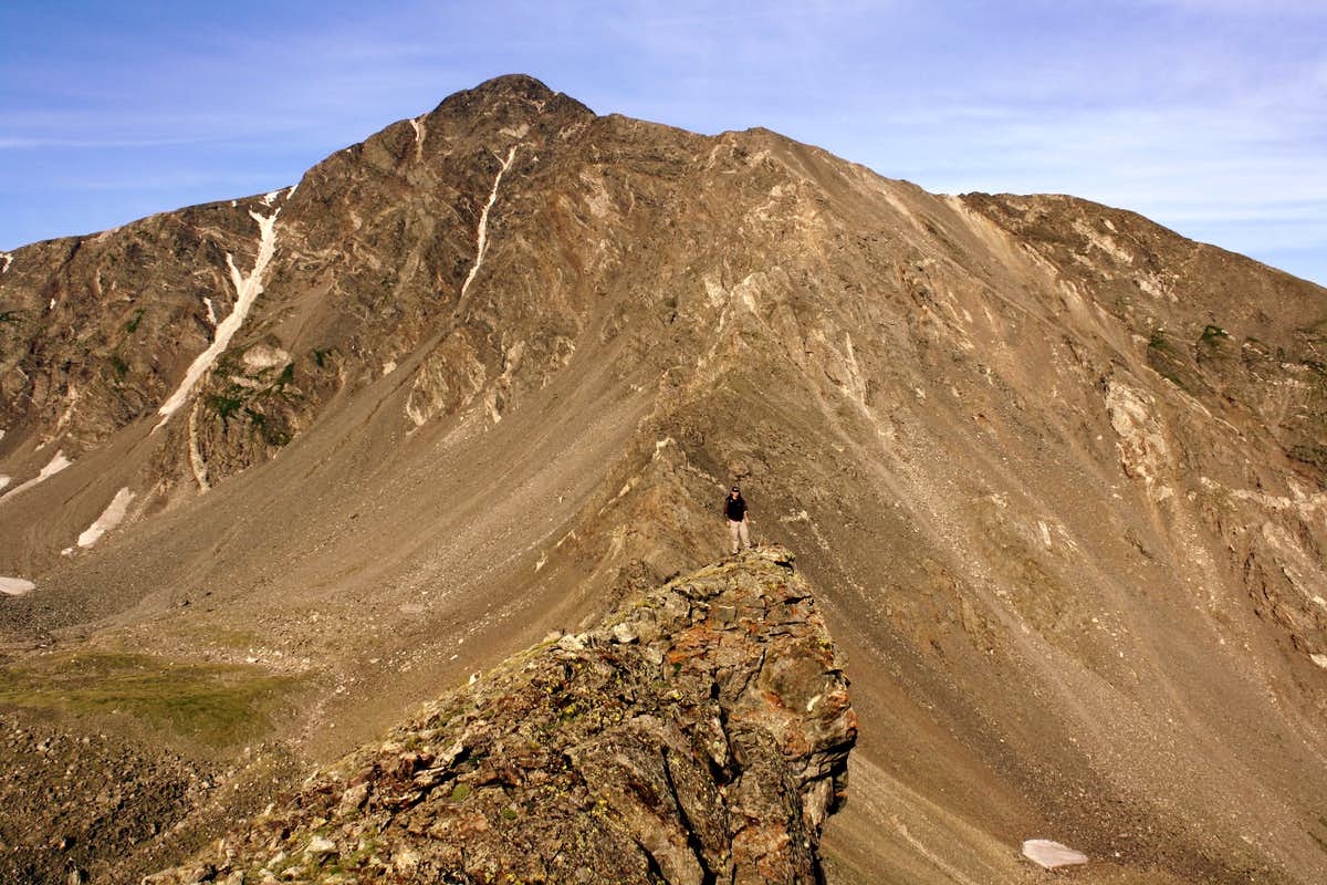
Ridge – A ridge is a linear area of sloping ground. It slopes down in three directions and up in one. Contour lines on a map will create a vee shape pointing down hill. Typically you will want to stay off a ridge if you are trying to stay concealed, instead traveling about 1/3 of the way down the slope, preferably on the side opposite anything you’re trying to avoid being seen by.

Saddle – A saddle is a low point between two high points. A saddle has high ground on two sides and low ground on two sides. On a topo map the contour lines make an hourglass shape. Saddles are great ways to get onto a ridge, serving as sort of a step up and down. They are also great place to cross a ridge since they can help you maintain a lower silhouette as you cross the ridge. Because of this they are also good places to set ambushes for two legged or four legged critters.

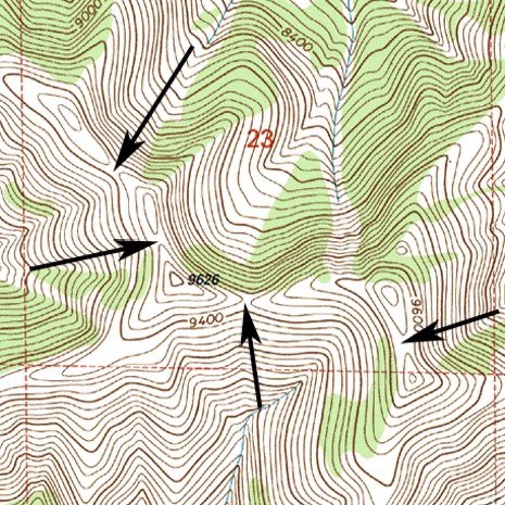
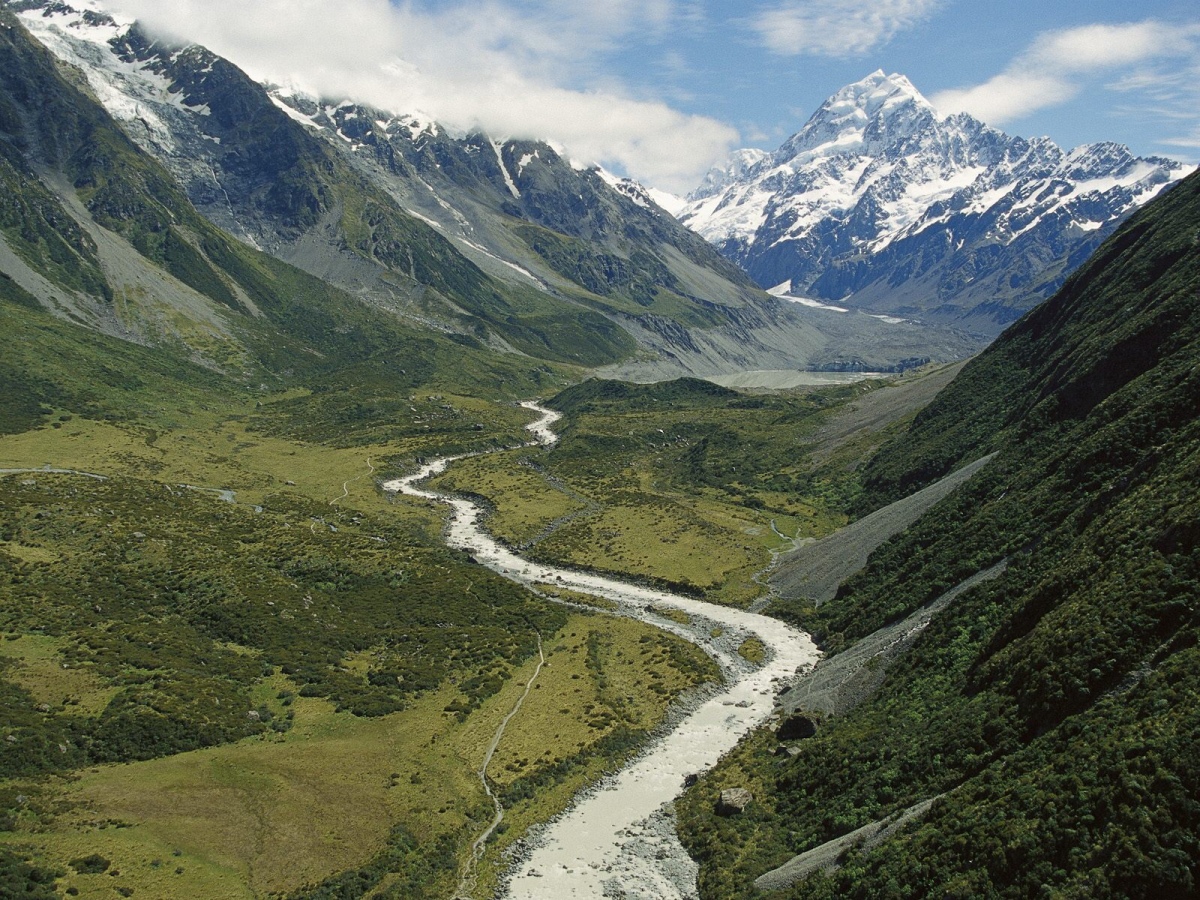
Valley – A valley is the mirror opposite of a ridge. Instead of linear sloping high ground, we have linear sloping low ground. You will have high ground on 3 sides, and low ground on one. A topo map will depict a valley with vee shaped contour lines pointing uphill. If there is water to be found in the area it very well could be in the bottom of a valley. Just like with a ridge, you don’t want to travel in the very bottom of a valley if you’re trying to stay hidden, instead choosing a route about 1/3 from the bottom.

Depression – Just like a ridge and valley are opposite each other, depressions and hills are also opposites. A depression is an area of ground lower than everything around it. If it has very steep sides it will be depicted by tic marks on the contour lines pointing inwards. Depressions will collect water and can also serve as good concealment.

Five Minor Terrain Features
In addition to the five major terrain features, we also have five minor terrain features. If we think of our major features as components of one large ridge line or mountain, we can also think of our minor features as components of our major terrain features.
Spur – A spur, or finger, is simply a smaller version of a ridge. It still has descending elevation in three directions and an incline in the other. It still creates vee shaped contour lines pointing downhill. Spurs are created along ridges, roughly perpendicular to the ridge crest. Just like we don’t want to walk along the top of a ridge, we also want to avoid sky lining ourselves on the top of a spur.

Draw – A draw is simply a smaller version of a valley. It still has a rise in elevation on three sides and a drop in one direction. It still creates vee shaped contour lines pointing uphill. The difference is that a draw is formed off the side of a ridge as well. It is the low area between two spurs. Oftentimes there will be a saddle at the top of a draw where it meets the ridge. Draws are typically the smaller feeder tributaries into a stream in the bottom of a valley.


Cliff – A Cliff is a sudden drop in elevation. These will be depicted by very close contour lines or contour lines that run together. They’re not too useful, unless you can climb or rappel..


The next two terrain features are sometimes referred to as supplemental instead of minor in some texts, but I find it easier just to lump them in with the minor. They are both man made terrain features pertaining to road beds.
Fill – A fill is a road way that has been created by building up the dirt. It can be a dirt trail, gravel road, paved or railroad tracks. It’s a level path that has been built over otherwise low terrain. They will often be depicted with tic marks pointing away from the road bed. On some maps the length of the tic marks will be equivalent to the width of the road, but not always.


So there you have it, The Five Major and Minor terrain features. In the next article I’ll describe how to use these in conjunction with some other tactics to plan navigation routes.
Share This Story, Choose Your Platform!

About the Author: NC Scout
4 Comments
Comments are closed.

Related Posts


Howitzer Clothing – Code AP15 for 15% OFF


CIVIL DEFENSE MANUAL – Only $56.29 This Month!


GUNS N GEAR


Looks like the last terrain feature got cut off, I should have proof read it better. Here is the missing paragraph:
Cut – A cut is made in a hillside to build a road bed into the hill. Dirt is removed from the hill until a wide enough path or road is made. There will sometimes be depicted with tic marks pointing towards the center of the road bed.
Excellent post. Land nav was the one individual skill I was really good at. Nothing more satisfying than moving through the woods. I still remember showing the ranger instructor where I was on the map 20 years ago!
I’ve been getting the boy up to speed on land nav, and just shared this with him as it is simply an excellent summary. Thanks!
That’s great Karl! I just learned about land navigation when I was about 12, it’s a great skill to know. Thanks!